Desertification 2 - The Rain Shadow and Interior Continental effects
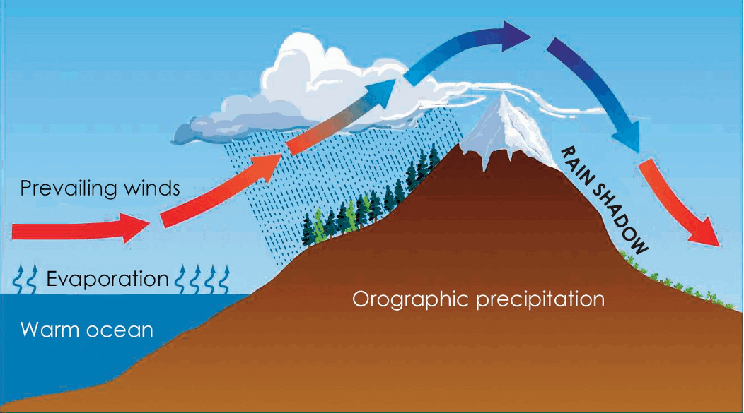
The first wonder of nature is 'the Rain Shadow' effect.
And here's a picture of how that works.
You might remember that eventually, most land water ends up back in the sea. That's part of the water cycle.
Then, the sun on the sea makes water evaporate,
and form clouds. More rain cycle.
But then - oh! Winds blow those clouds towards land, and if those winds are in the same direction most of the time, they are called 'prevailing winds'. When those winds reach land, often there will be hills or higher ground at the coast. Sometimes even mountains or high cliffs!
Here are cliffs in England, made mostly from
chalky rock.
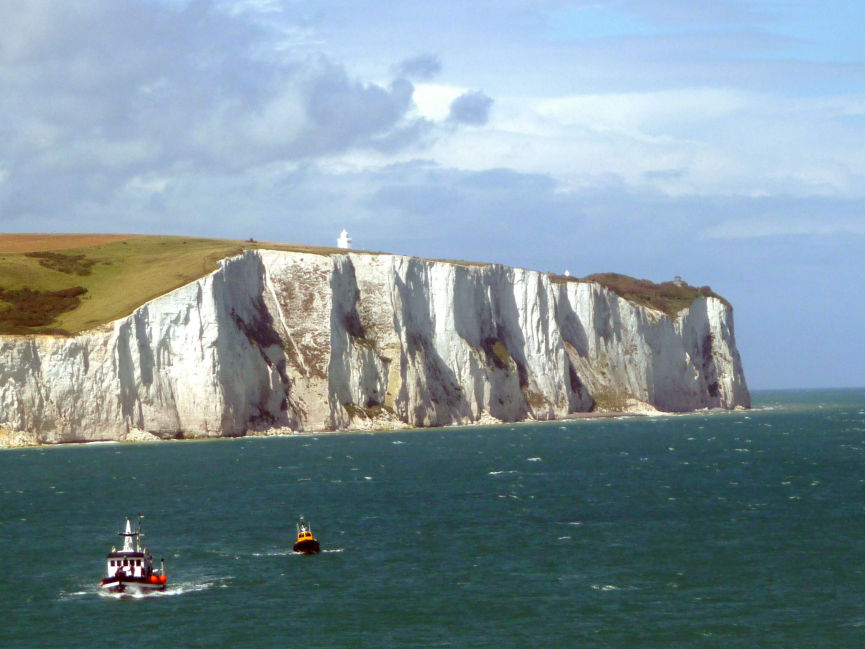
When the land suddenly stops, those big drops are called 'cliffs'.
Here are some much more dramatic cliffs .
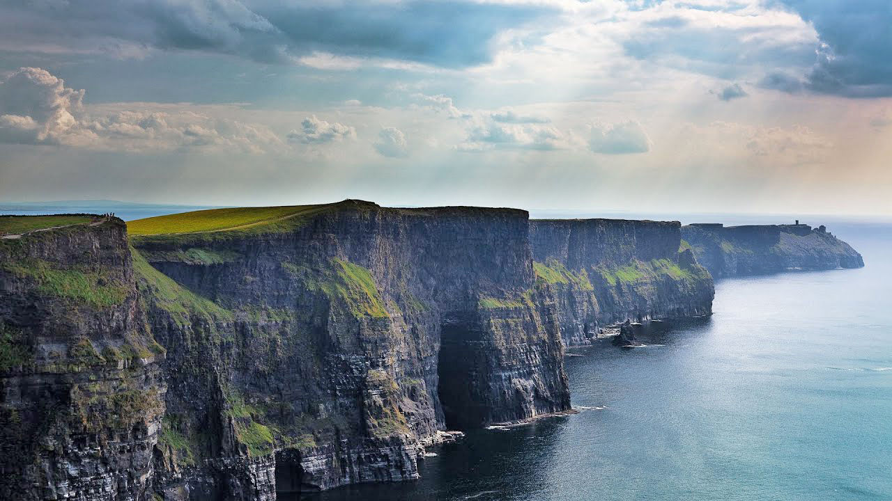
Very beautiful but also very dangerous.
And so, when the clouds meet the cliffs, the clouds have to rise, and the higher they get, the more concentrated with moisture they become, and the drop that moisture as rain or snow.
Going up the side of the mountains, most of the rain falls, then at the top, maybe snow, and then the clouds are 'empty'. That just means they don't have enough moisture to rain or snow any more.
The 'rain shadow' happens on the other side of the mountain or hill, where no rain or snow falls.
Just like a shadow of us from the sun, the shadow is where there's no light.
And the rain shadow is where there is no rain.
Mountain ranges act as orographic barriers – they force the moist maritime (ocean) winds to rise and cool. This creates rain on the windward slopes – ‘relief rainfall’. The air then moves inland and descends. It is warm and dry – this is the rain shadow effect.
For example: Atacama, South America: prevailing south east trade winds carry moist air off the Atlantic. This is forced to rise over the Andes mountain range.
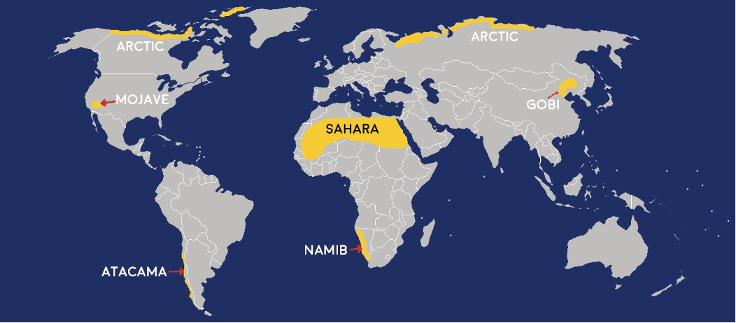
On this map again (above), the
Atacama desert is in the bottom
left of South America.
Just past that desert, is a range of mountains called 'The Andes'.
And for the Atacama desert, The Andes for the orograhic barrier.
By the time the winds and clouds have passed overThe Andes, there's not much moisture left in the clouds to fall as rain.
Now, here's a question.
Before Australia was discovered, which
was the largest island in the world?
Australia! It just had not been found.
And here IS Australia!
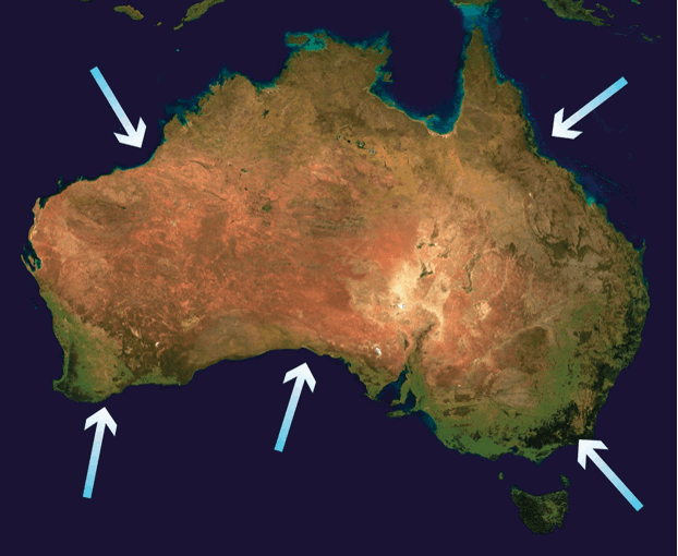
In real life, there are no white arrows in the sea 😛 but on this map, those arrows show the directions from which winds come.
Around the edges (coastline) of Australia, there are mountains and hills, and higher ground than in the middle.
And that's a bit of a problem for Australia.
All around the edges, they get plenty - sometimes too much - rain, but in the middle, the rain shadow effect means that there's not much moisture left in the clouds to fall in the middle of the continent (which is also a country).
Moist air off the sea drops its moisture as it arrives over the land. By the time it reaches the continental interiors, most of the moisture will have been dropped, so the winds are dry, and there will be little rain.
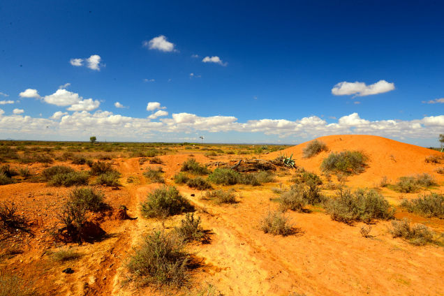
Here's what much of the interior of Australia is like.
But here's the coast of Australia (below), and that is caused by the rain shadow effect.
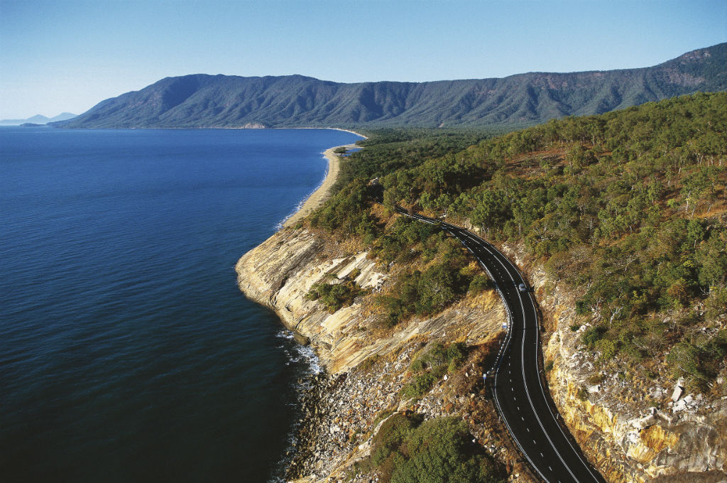
Even on this map, from a satellite, you can see the colours - greener around the edges and reds and yellows in the middle.
Which also means that Australia is mostly like a desert in the middle.
Does anyone know what the Australians call the middle of their country?
They call it the outback, which literally means ... for some of the people, it is out the back of their houses that the sand starts.
Other deserts have the same situation - the Gobi desert in Asia and the Iranian desert in Africa
So those are the rain shadow and continental interior effects.
Use Line, Facebook, email or IG
