South Africa - A Case Study - Climate 1 - General Patterns
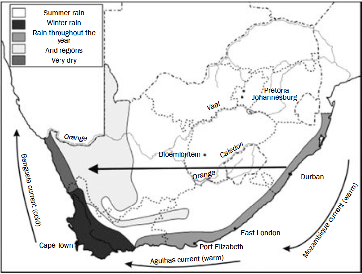
This picture shows the rainfall in the seasons across South Africa.
Where it is white, there is summer rain, where it is darkest, winter rain, mid-grey - rain all the time LOL and then almost dark, very dry regions.
The black arrow shows how rainfall decreases from east to west across the country mainly due to the Mozambique and Benguela currents.
• The east coast gets rain all year round, so it will have a higher rainfall.
• The west coast is an arid (desert)region so it receives very little rain.
As I am sure you can work out, by the time the clouds get all the way across the continent, they don't have any rain left. And, as the weather travels east to west, the east gets the rain and the west mostly does not.
This weather or climate pattern is caused by the ocean currents, carrying warmth from the east to the west. That very warmth contains the moisture which creates rain, eventually.
And there's more!
You might remember that around mountains there's something called the 'rain shadow':
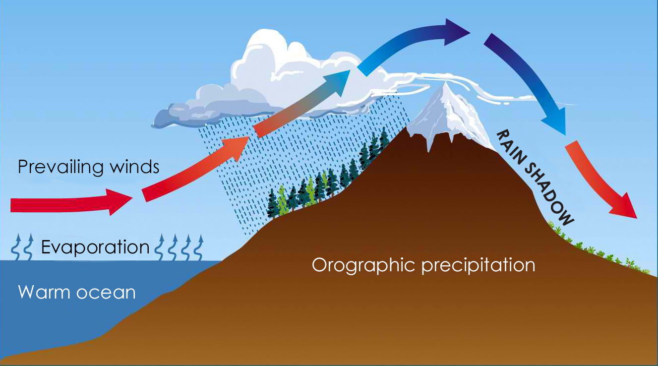
(The picture shows the opposite way from South Africa.)
The only real difference is, that when the rain has fallen on the mountains or hills, the clouds reach a plateau.
Generally, when a country or a continent is mainly on a plateau, the middle tends to be a bit cooler than the edges. This is because it is the raised ground in the centre of the plateau.
Therefore, places on the plateau (high altitude) will experience lower temperatures than places at a lower altitude.
Places in the Lowveld (Mpumalanga) have higher temperatures than places on the Highveld (Gauteng and Free State) in South Africa.
The impact of the subtropical high pressure belt on South Africa’s climate.
This is in the online booklet at page 13.
Generally, South Africa is affected by 3 high pressure weather cells.
These cells are called:
• South Atlantic high pressure (SAHP)
• South Indian high pressure (SIHP)
• Kalahari high pressure (KHP)
and here in a picture is where they do their work:
The one right in the middle, the Kalahari high pressure, work its system on the plateau.
The Kalahari is an arid area, and most people do indeed call it the Kalahari Desert.
The lighter area of this picture (below) is the area of the Kalahari Desert.
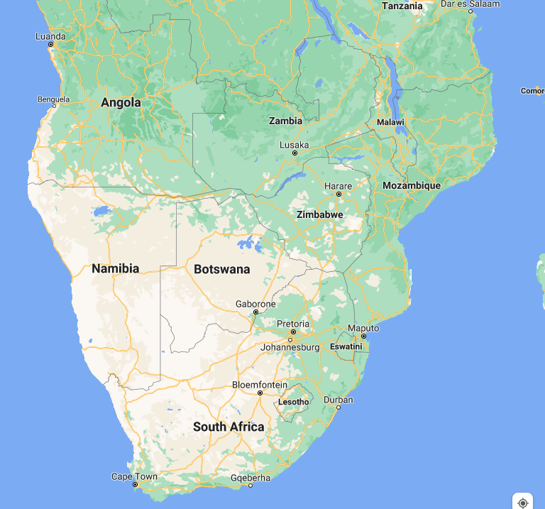
You may also remember that the full-on Namib Desert is there somewhere - and actually it covers most of Namibia, which is on the left of the picture.
A plateau - like countries - does not stop at a national border, so almost the whole of the lower continent is on the plateau.
And it has plateau weather!
Looking again at these:
• The South Atlantic high pressure causes cool, dry winds to blow onto the south-western Cape.
• The South Indian high pressure causes warm, moist winds to blow onto the east coast.
• The Kalahari high pressure has the greatest impact on South Africa’s climate.
Which again is quite obvious because it's the one right in the centre of South Africa
It has two main effects:
1) It causes generally clear skies and warm temperatures because the air is descending and dry (in winter)
and
2) It results in only summer rainfall occurring on the plateau.
In this way, the plateau and the weather cells change the weather in different parts of South Africa.
Use Line, Facebook, email or IG

Offline Website Builder