South Africa - A Case Study - Weather Systems 1
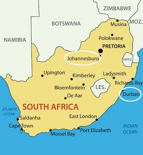
Pretoria is the administrative capital of South Africa. Cape Town is the legislative capital, and Bloemfontein is the judicial capital.
You can see Johannesburg and Durban ringed, and that just means there's a difference in their climates - when we discuss climates.
That's because Durban is on the coast and Johannesburg is inland
What factors affect the South African climate?
There are three factors that have the greatest impact on South Africa’s climate:
• South Africa is surrounded by oceans and ocean currents.
• South Africa is mostly found on a plateau.
• South Africa is affected by the subtropical high pressure belt.
There are other, smaller influences but those have the greatest effect.
These three factors cause the typical weather experienced in each season.
We’ll look at each factor in more detail.
First, the impact of the ocean and the ocean currents on South Africa’s climate
An ocean current is not just a little bit of water moving near a beach, not tides and so on, but vast quantities of water moving around the world.
If you ever saw Finding Nemo, you will remember the turtle who flowed down an huge ocean current.

That current was the South Australian Current.
Much of South Africa is surrounded by oceans. The oceans affect the temperature at the coast and inland as follows:
• Water heats up slowly and cools down slowly.
As the water moves away from Antarctica, up one side of SA, it gets a bit warmer.
As it moves down the other side of SA, it gets a bit cooler.
• This moderates temperatures along the coastline (i.e. the minimum and maximum temperatures are not very far apart) – also known as maritime changes.
To moderate in this context means to smooth out.
For example - no extreme cold, no extreme hot around the coastline.
Thos are maritime effects. And maritime is to do with the oceans.
This causes temperatures inland to be extreme (i.e. the minimum and maximum temperatures are very far apart) – also known as continental changes.
If something is continental, it is not at the ocean's edges but inside, more away from the coast.
For example, in winter the temperature in Johannesburg (ringed on the map) is a maximum of 25°C and a minimum of 1°C (extreme), whereas in Durban (ringed on the map) the maximum is 24°C and the minimum is 15°C (moderate).
It is the effect of the ocean's currents which cause the variations in temperatures.
Here's a list, followed by a picture, of the main currents around SA. (The ocean currents also affect the temperatures and rainfall):
• The currents on the east and west coasts have the greatest impact on South Africa’s climate.
• The warm Mozambique current flows along the east coast.
• The cold Benguela current flows along the west coast.
• The warm Mozambique current causes high temperatures and more rain on the east coast.
• The cold Benguela current causes low temperatures and less rain on the west coast.
That's the whole of Africa, of course because the currents do not just flow around one country.
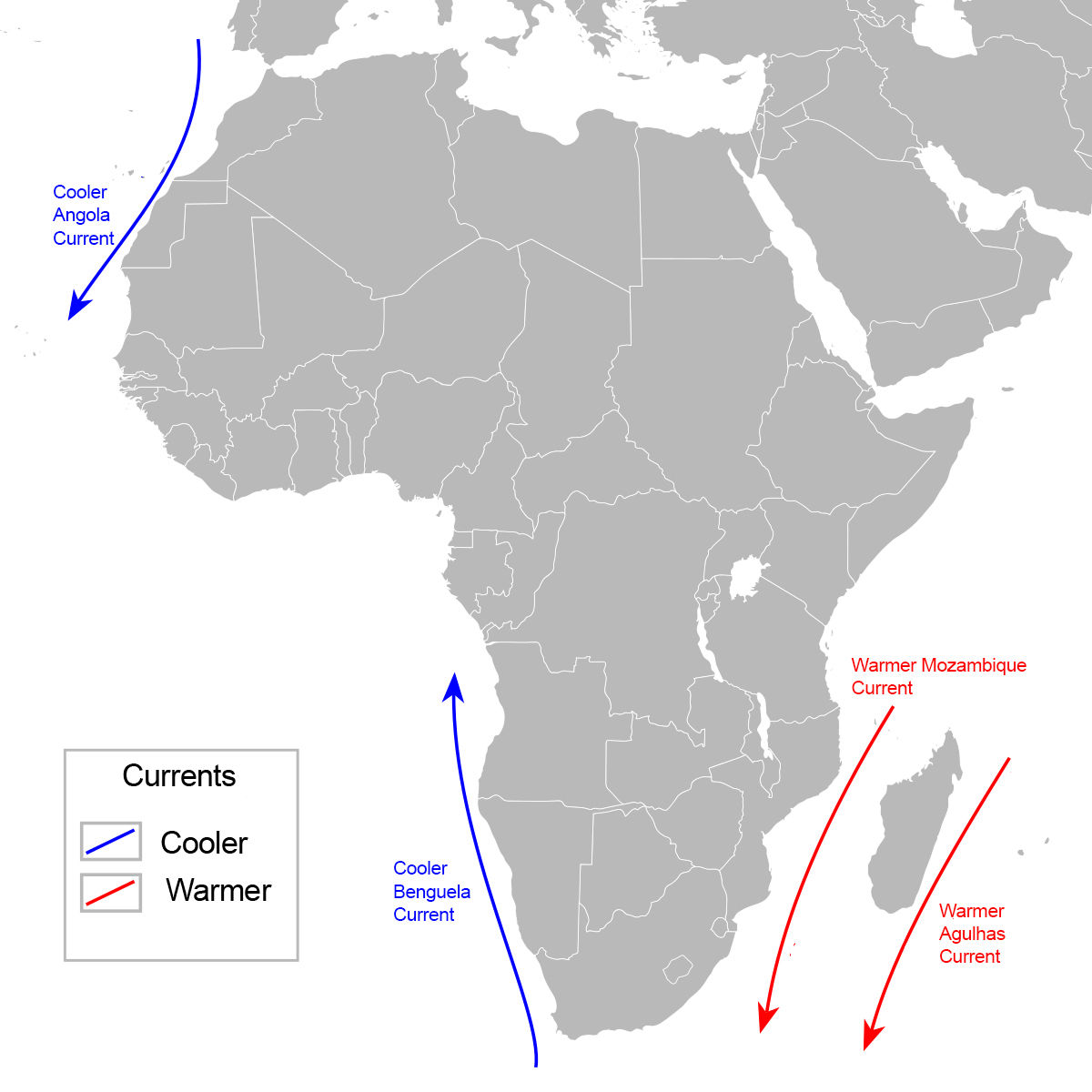
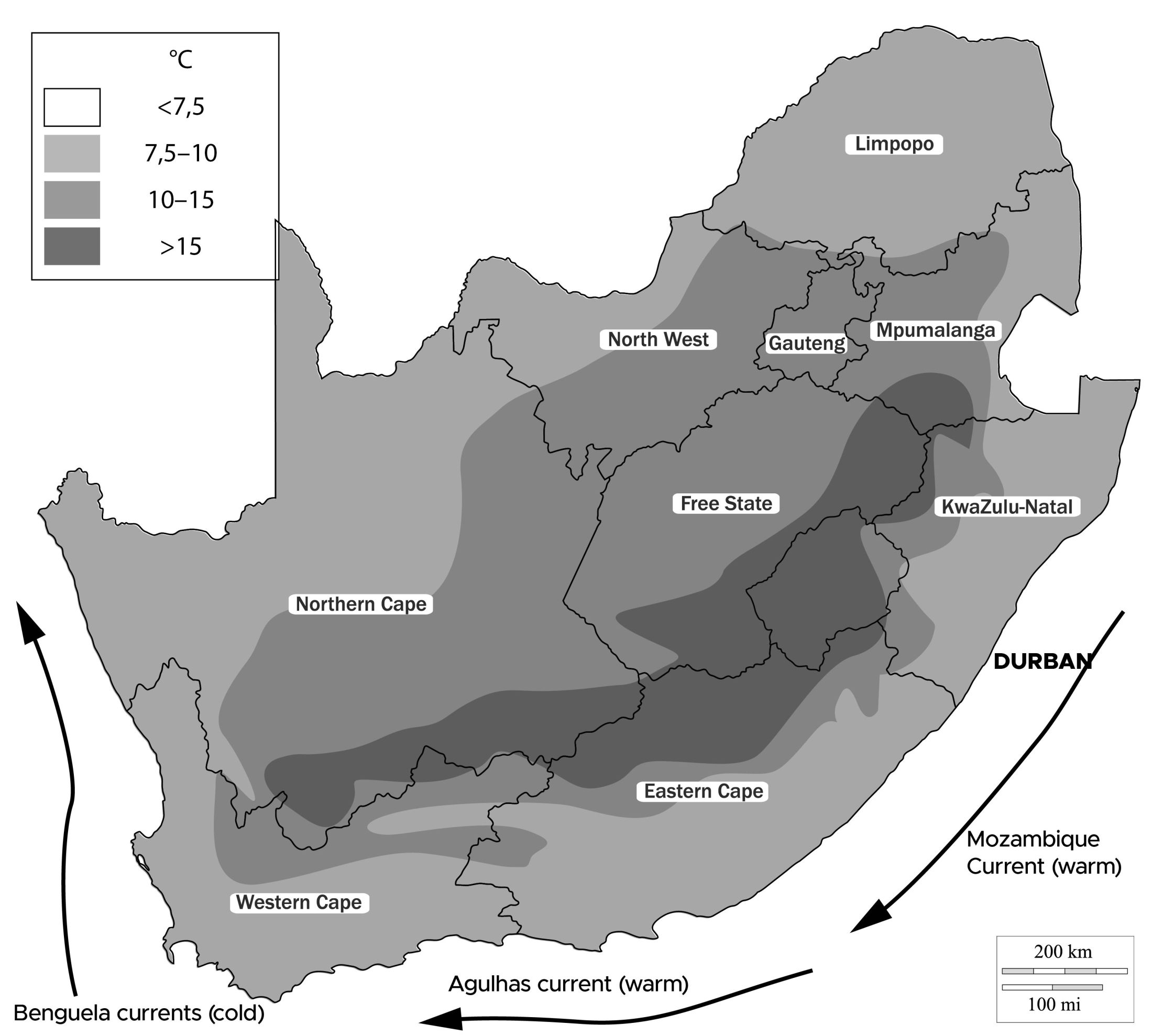
Above is a map showing the three ocean currents and their effect on minimum temperatures:
And it is fairly clear that the darker the colour, the hotter the temperature, and the lighter the colour, the cooler the temperature.
Just like Thailand, actually, where the interior is hot and nearer the coast is less hot.
The above map shows how the warmer or cooler currents affect the temperatures of parts of South Africa.
You might remember that South Africa is based on a plateau.
What is a 'plateau'?
Here's a diagram:
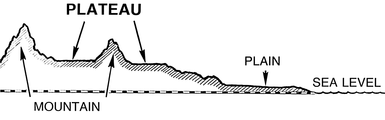
Flat land, often between mountains or hills.
Who can tell me what the difference is, between a mountain and a hill?
A HILL is up to 999 feet high (304.495m) and a Mountain is 1000 feet or more high (304.8m) - a small difference; then it changes from a hill to a mountain. But of course they had to make a division somewhere.
Use Line, Facebook, email or IG
